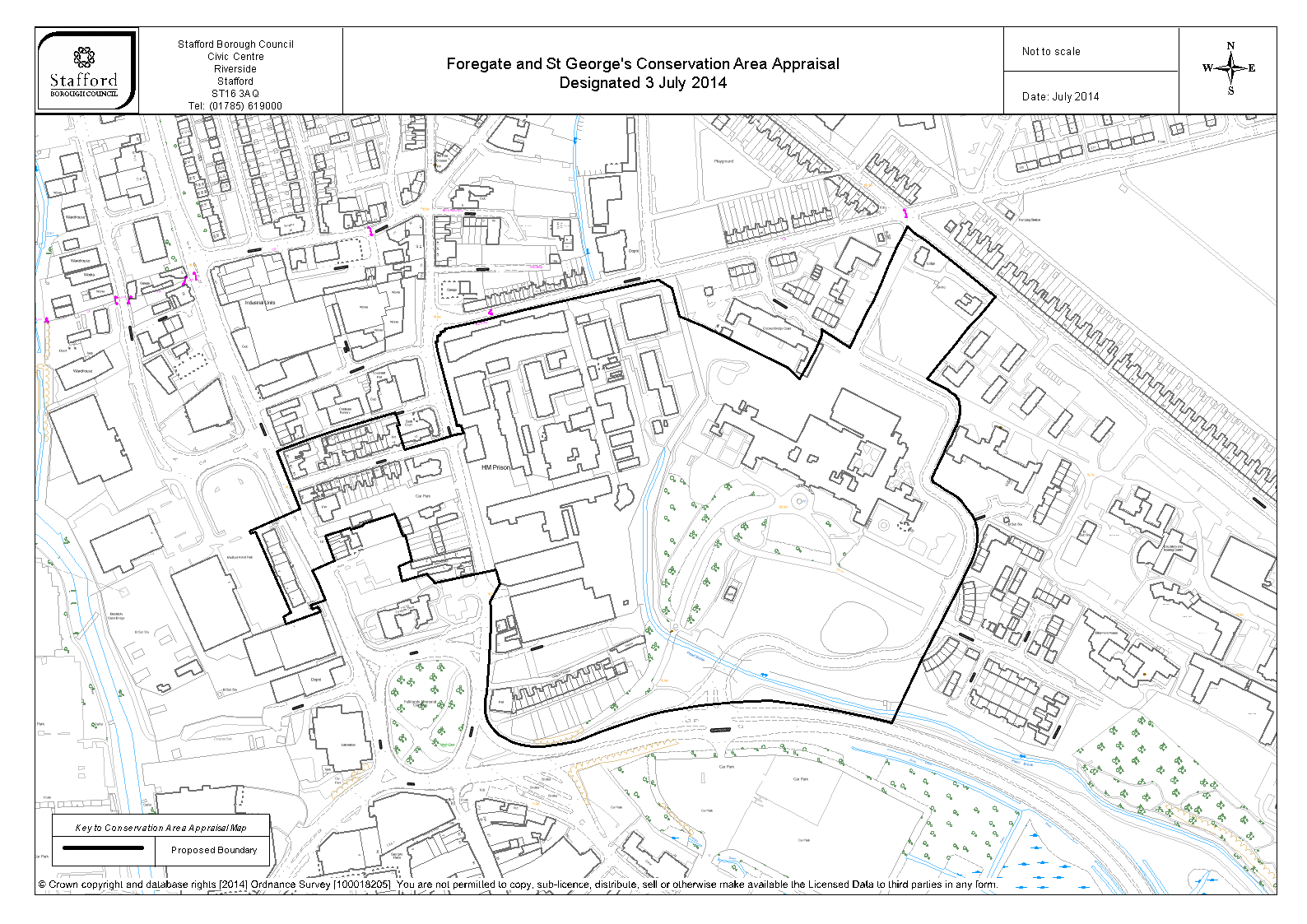
Solar panels, heat pumps and insulation in Foregate & St. Georges conservation area
In the Foregate & St. Georges conservation area (Stafford), external wall insulation needs planning permission, and so does an air source heat pump on a wall or roof facing the road; one at the back or side, internal and loft insulation and solar panels on a roof slope normally do not. The area has 8 listed buildings; on a listed building solar panels and heat pumps are not permitted development at all and need planning permission and listed building consent. 224 homes inside the boundary have an energy certificate: 19.2% are solid-wall homes with no wall insulation, 52.7% heat with a gas boiler and 57.1% are rated D–G; 0 have a heat pump. EPC register November 2026; rules as at 21 October 2026.
Data: EPC register November 2026 (latest certificate per home), conservation area boundaries 3 November 2026, permitted development rules as at 21 October 2026 · calculated 5 November 2026 · Methodology and sources
224homes with an energy certificate
19.2%solid walls, no insulation
52.7%heated by a gas boiler
0heat pumps
Article 4: Stafford publishes its Article 4 areas on planning.data.gov.uk and none overlaps this area; a direction can still exist on paper, so check with the council.
What needs planning permission in Foregate & St. Georges
Work (house, not listed)
In a conservation area
Rule
Air source heat pump on a wall or roof facing the road, or nearer the road than the house
Planning permission needed
Part 14 Class G, G.1(j)
Air source heat pump at the back or side (outdoor unit up to 1.5 m³, MCS Planning Standards, one per house — two on a detached house)
No permission needed (permitted development)
Part 14 Class G
Solar panels on a pitched roof (up to 0.2 m proud, not above the ridge)
No permission needed (permitted development)
Part 14 Class A, A.2(c)
Solar panels on a wall, balcony or roof enclosure facing the road
Planning permission needed
Part 14 Class A, A.2(e)
Solar panels on a flat roof (up to 0.6 m above the roof)
Replacement windows and doors of similar appearance
No permission needed (permitted development)
Part 1 Class A, A.3(a)
Listed buildings: 8 in the area (grade I: 0, II*: 1). The table is for houses that are not listed: on a listed building, solar panels and air source heat pumps are not permitted development at all (they need planning permission), and any of these works needs listed building consent.
Flats: 64% of the certified homes here are flats or maisonettes. Homes in a block of flats have no householder rights for alterations; heat pumps and solar have their own, tighter rules for blocks of flats.
The homes in the area (latest certificate per home, n = 224)
Walls
Homes
Share
Modern wall (U-value from the design)
169
75.4%
Solid wall (brick or stone), no insulation
43
19.2%
Cavity wall, insulated (as built or unspecified)
8
3.6%
Solid wall, internal insulation
2
0.9%
Solid wall, external insulation
1
0.4%
Solid wall, insulated
1
0.4%
Heating
Homes
Share
Gas boiler
118
52.7%
Electric (storage heaters, panels, boiler)
105
46.9%
Communal heating
1
0.4%
Loft / roof insulation
Homes
Share
No insulation
9
4.0%
Under 200 mm
16
7.1%
200 mm or more
21
9.4%
Insulated (depth not recorded)
4
1.8%
Flat or other home above
102
45.5%
Other
72
32.1%
Windows
Homes
Share
Double glazed
219
97.8%
Single glazed
4
1.8%
Secondary glazing
1
0.4%
BCD
Energy rating: B 49 (21.9%) · C 47 (21.0%) · D 110 (49.1%) · E 16 (7.1%) · F 1 (0.4%) · G 1 (0.4%). Houses and bungalows: 36% of the homes; solar panels on 0.0% of the certificates. Most common build period on the certificates: 2015. Designated: 21 June 1996.
Compared with Stafford and England
Share of homes
Foregate & St. Georges
All 29 areas in Stafford
England
Solid walls, no insulation
19.2%
35.7%
48.7%
Gas boiler
52.7%
58.4%
66.4%
Rated D–G
57.1%
—
56.5%
Caveats
Certificates describe a home when it was assessed; 17% of these are from 2020 or later (latest 29 October 2026). “No insulation (assumed)” is the assessor's default for older walls.
The rules are England's national permitted development rules (General Permitted Development Order 2015, Schedule 2, as at 21 October 2026). They do not cover building regulations or a council's own conditions. This is not a planning decision: ask Stafford if in doubt.
Boundary: Stafford Borough Council via planning.data.gov.uk (entity 44015884, reference 6, 14.3 ha); the council's appraisal or map. Homes are placed by the coordinates of their UPRN (OS Open UPRN); addresses are not shown.